
Description
In 1954 the settlements of Cumberland and Westmorland are listed together, with only three sites listed, and only one of those, Eston, in Cumberland (Beresford 1954, 345). Only eight settlements were included in the 1968 Gazetteer, and they are all concentrated in a small area to the north of the Lake District, close to the Scottish Border. Cumberland is also highlighted as one of the 15 counties which require considerable local research. It is a little confusing why some of the earlier work in the county had not been used when compiling the list. For example in 1963 William Rollinson published a paper entitled ‘The lost villages and hamlets of Low Furness’ (Rollinson 1963). This suggested at least five lost settlements in this one small area. It also explored the theories which appeared from the 1770s onwards as to why these settlements disappeared including tidal inundations and monastic developments.
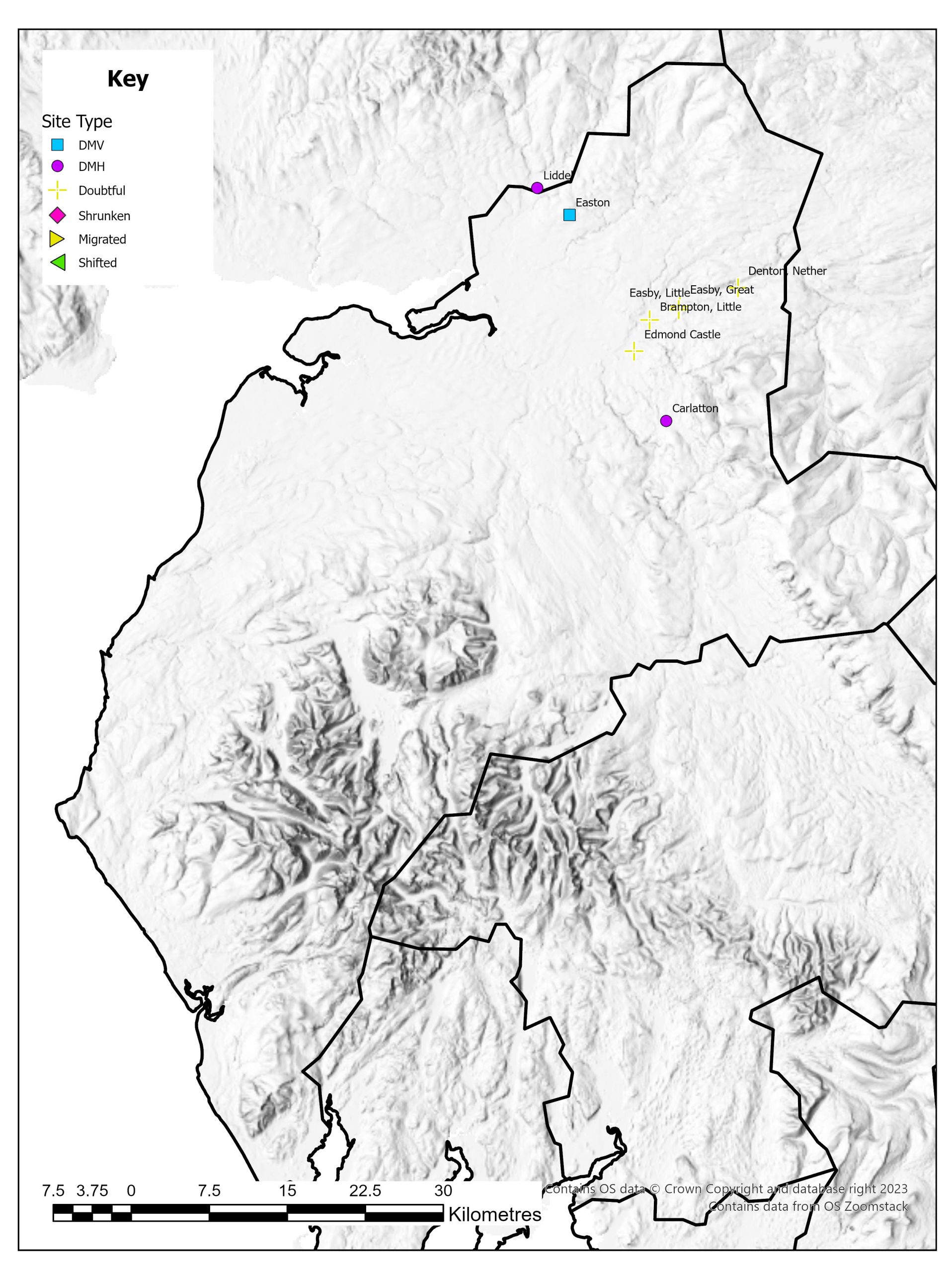
With many of the sites identified in Cumberland it is questionable whether there was ever extensive settlement. The documentary record is patchy, but those settlements with records seem to have declined in the fourteenth century. Since 1968 there has been extensive research carried out on the settlement of the county which has vastly increased the number of settlements classed as deserted. Analysis of the general settlement pattern over much of Cumberland has also highlighted the high percentage of dispersed settlements consisting of single farmsteads or a couple of dwellings (Newman 2006, Newman 2009). The landscape of the area is varied though and in some areas classical nucleated settlement can also be found. This pattern seems to have a long history. Not only does this make understanding the true pattern of desertion across the county difficult, there is also the issue that it can be difficult to indentify medieval dispersed settlement as they are ‘more easily rendered ‘invisible’ by later land use’ (Newman 2006: 121). The Research Agenda for the North West has prioritised the investigation of the evolution of dispersed settlement the ways settlement expanded into marginal areas in the medieval period (Newman and Newman 2007). Due to this level of dispersed settlement, of the eight settlements identified in 1968, many have been classified by this website as doubtful medieval villages.
Excavations
No excavations have been undertaken on these sites.
County Boundaries
The county that was Cumberland in 1968 is now Cumbria. There have been very few county boundary changes. Cumberland was in existence by the twelfth century but has always been an area of dispute between England and Scotland. The only slight boundary changes that have occurred are small sections exchanged with Lancashire.
Documentary Evidence
Cumberland, as with other northern counties such as Cheshire and Westmorland, often does not appear in the main documentary sources used by this website. In some periods it belongs to Scotland, at other times it is exempt from taxation due to Scottish raids and troubles. This does make the issue of identification and tracking the fortunes of settlement that little more complex.
Cumberland as a county was not recorded in the Domesday Book. A small number of places are recorded in the Domesday record for Yorkshire, but this is limited to just four places (Faull and Stinson 1986).
There was no tax in 1334 due to recent devastation by the Scots so Glasscock has substituted this with the 1336 tax figures (Glasscock 1975: xxiii). It is suggested that due to ongoing devastation from the Scots the payments are probably low (Glasscock 1975: 36). There has been limited survival of fourteenth-century taxation documents for the whole of Cumberland. Only one nominative list has survived from the 1377 Poll Tax (Fenwick 1998: 90). While this membrane is in good condition, it refers solely to Carlisle and does not refer to any of the deserted settlements. There are no surviving records for 1379 or 1381. Cumberland was not assessed in the main sixteenth-century taxation documents covered by this website (Sheail 1998: 3).
Taken as a whole the lack of taxation documents does makes studying the settlements of Cumberland a more complex task. Records have survived for the 1291 Taxatio and the 1563 Diocesan Return, and where this may indicate a church and associated living, it does not help disentangle the complexity of settlement dispersal as it would appear that, from a couple of the examples, the presence of a church does not equate to the presence of nucleated settlement.
County Records
Two Historic Environment Records cover the area of Cumberland. The Cumbria HER (administered by Cumbria County Council) and the Lake District HER (administered by the National Park Authority). With Cumbria HER you can access basic online records at on their website. The Lake District HER can be accessed through Heritage Gateway. Founded in 2010, the Cumbria County History Trust is coordinating the writing of Victoria County History volumes for the county and is compiling township histories which can be found on their website.
References
Beresford, M.W. 1954. The Lost Villages of England. London: Lutterworth Press.
Faull, M.L. and M. Stinson 1986. Domesday Book: Yorkshire Part Two. Chichester: Phillimore.
Fenwick, C.C. 1998. The Poll Taxes of 1377, 1379 and 1381: Part 1: Bedfordshire-Leicestershire. Oxford: Oxford University Press.
Glasscock, R.E. 1975. The Lay Subsidy of 1334. London: Oxford University Press.
Newman, C. 2006. The Medieval Period Resource Assessment. Archaeology North West 8: 115-144.
Newman, C. and R. Newman 2007. The Medieval Period Research Agenda. Archaeology North West 9: 95-114.
Newman, R. 2009. A Guide to Using the Cumbria Historic Landscape Characterisation Database For Cumbria’s Planning Authorities. Cumbria County Council Unpublished Report.
Rollinson, W. 1963. ‘The Lost Villages and Hamlets of Low Furness’, Transactions of the Cumberland and Westmorland Antiquarian and Archaeological Society 63: 160-169.
Sheail, J. 1998. The Regional Distribution of Wealth in England as Indicated in the 1524/5 Lay Subsidy Returns: Volume One. London: List and Index Society.
List of deserted villages recorded in 1968
- Brampton, Little
- Carlatton
- Denton, Nether
- Easby, Great
- Easby, Little
- Easton
- Edmond Castle
- Liddel