
Description
In 1954 a total of six villages were listed by Beresford, all which appear in the later list and are mainly those identified through isolated churches (1954: 350). There were 17 settlements recorded in the 1968 Gazetteer. Of these nine are unlocated settlements recorded in Domesday and the majority of the remaining identifications continue to be based on the presence of ruined or destroyed churches. A number of the settlements have had a chequered history and been added to, removed and added back to the lists of deserted settlements such as Wickham Bishops (DMVRG 1962, DMVRG 1963). In 1977 Warwick and Kirsty Rodwell undertook a survey of churches in Essex, particularly those that were threatened and derelict (Rodwell 1977). Within this several of the churches at sites of deserted medieval settlement were reviewed. However it is unclear whether these ever formed centres of a nucleated settlement or if they were instead serving a widely dispersed parish. Since the original Gazetteer more sites have been identified but again some of these are simply on the basis of an isolated church.
Investigation into the medieval landscape of Essex has not been extensive (Rippon 2008: 181). There is evidence of much dispersed settlement (Martin 2012: 234-35). Rippon has reviewed the nature of the landscape as part of the ‘Great East Anglia’ and the nature of settlement outside of the nucleated village zone which highlights the variation of settlement in the area (Rippon 2008).
Detailed research has been published into the affects of the Black Death on the Essex population and this paints a picture of high mobility, but one that was present before the events of 1349. It also showed that the pattern in Essex of the rural population and society is one that cannot be used across the country as a whole (Poos 1991).
Excavations
None of the settlements on the 1968 Gazetteer have been excavated, and none of them show evidence of buried remains from aerial photographs or the presence of earthworks, apart from church remains. The National Mapping Programme of aerial photographs undertaken on behalf of English Heritage did not highlight many medieval features, with moated sites being one of the most common (Ingle and Saunders 2003). However in general there has been considerable valuable work undertaken in the county looking at a range of site types from moated sites, to farmsteads, mills and industrial sites (Medlycott 2006). All this work has confirmed the dispersed nature of settlement in the county. It has also shown that a number of sites have been abandoned in the fourteenth century, something alluded to by Poos (1991) (see Medlycott 2006: 5). There has also been a historic settlement assessment of 29 parishes in the county (Medlycott 2011: 61).
County Boundaries
There have been a number of small changes to the boundary of Essex over time with losses to Hertfordshire, East Suffolk, Cambridgeshire and Greater London, but it has also gained areas from Hertfordshire, East Suffolk and Cambridgeshire. The county now comprises the County of Essex and the Unitary Authorities of Southend-on-Sea and Thurrock.
Documentary Evidence
The 1334 Lay Subsidy record is complete, with only six places taxed with Essex in 1334 having moved to neighbouring counties (Glasscock 1975). The 1377 Poll Tax return is not complete but does cover many settlements within the county (Fenwick 1998). A later discovered document does fill in many of the gaps (Fenwick 2005). None of the returns for the 1379 Poll Tax survive for Essex (Fenwick 1998). The 1381 Poll Tax return covers less of the county than the 1377 return, but does fill a number of the gaps left by the 1377 return (Fenwick 1998). For the sixteenth-century lay subsidies the records are defective with the 1524 being the most complete. The later subsidy for 1543/44 is not available (Sheail 1998: 87). The Diocesan Returns also do not survive (Dyer and Palliser 2005).
County Records
The Essex HER can be accessed online at the Unlocking Essex’s Past website. This covers the areas of the County of Essex and the Unitary Authority of Thurrock. A separate HER covers the Unitary Authority of Southend and this is not currently available online. There is also a separate Urban Database for the archaeology of Colchester that can be viewed online via Heritage Gateway.
References
Beresford, M.W. 1954. The Lost Villages of England. London: Lutterworth.
DMVRG 1962. ‘Appendix B: List of Sites Deleted from ‘The Lost Villages of England’ Between 1954 and 1962’, Deserted Medieval Village Research Group Annual Report 10: Appendix B.
DMVRG 1963. ‘Appendix A: Deserted Medieval Villages – New Sites 1963’, Deserted Medieval Village Research Group Annual Report 11: Appendix A.
Dyer, A. and D.M. Palliser 2005. The Diocesan Population Returns for 1563 and 1603. Oxford: Oxford University Press.
Fenwick, C.C. 1998. The Poll Taxes of 1377, 1379 and 1381: Part 1: Bedfordshire-Leicestershire. Oxford: Oxford University Press.
Glasscock, R.E. 1975. The Lay Subsidy of 1334. London: Oxford University Press.
Ingle, C. and H. Saunders 2003. National Mapping Programme Essex: Management Report. Unpublished Report Essex County Council and English Heritage.
Martin, E. 2010. ‘Norfolk, Suffolk and Essex: Medieval Rural Settlement in ‘Greater East Anglia’, in N. Christie and P. Stamper (eds) Medieval Rural Settlement in Britain and Ireland AD 800-1600: 225-248. Oxford: Windgather.
Medlycott, M. 2006. ‘Sweet Uneventful Countryside: Excavated Medieval Farms and their landscape in Essex’, in N. Brown and M. Medlycott (eds) Research, Planning and Management: the East of England Archaeological Research Framework Review http://www.eaareports.org.uk/FW_Medlycott.pdf
Medlycott, M. 2011. Research and Archaeology Revisited: a Revised Framework for the East of England. Norwich: East Anglian Archaeology Occasional Paper No.24.
Poos, L.R. 1991. A Rural Society: After the Black Death: Essex 1350-1525. Cambridge: Cambridge University Press.
Rippon, S. 2008. Beyond the Medieval Village: The Diversification of Landscape Character in Southern Britain. Oxford: Oxford University Press.
Rodwell, W. 1977. Historic Churches: a Wasting Asset. London: Council for British Archaeology Research Report 19
Sheail, J. 1998. The Regional Distribution of Wealth in England as Indicated in the 1524/5 Lay Subsidy Returns: Volume One. London: List and Index Society.
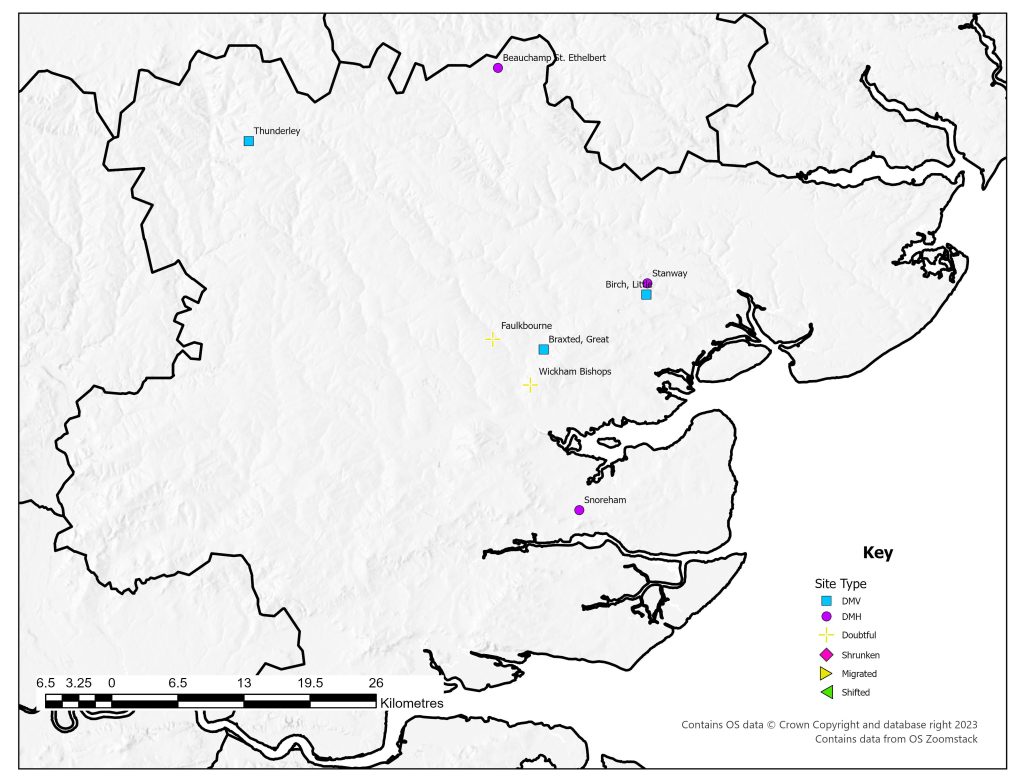
List of deserted villages recorded in 1968
Site names in italics are unlocated and so do not appear on the VIllage Explorer. For the unlocated sites, click on their names and it will take you to the basic information about this village.
- Beauchamp St. Ethelbert
- Berewic
- Bertuna
- Birch, Little
- Braxted, Great
- Cheneboltuna
- Faulkbourne
- Lega
- Nortuna
- Scilcheham
- Snoreham
- Stanway
- Thunderley
- Udecheshale
- Weneswic
- Westnanetuna
- Wickham Bishops