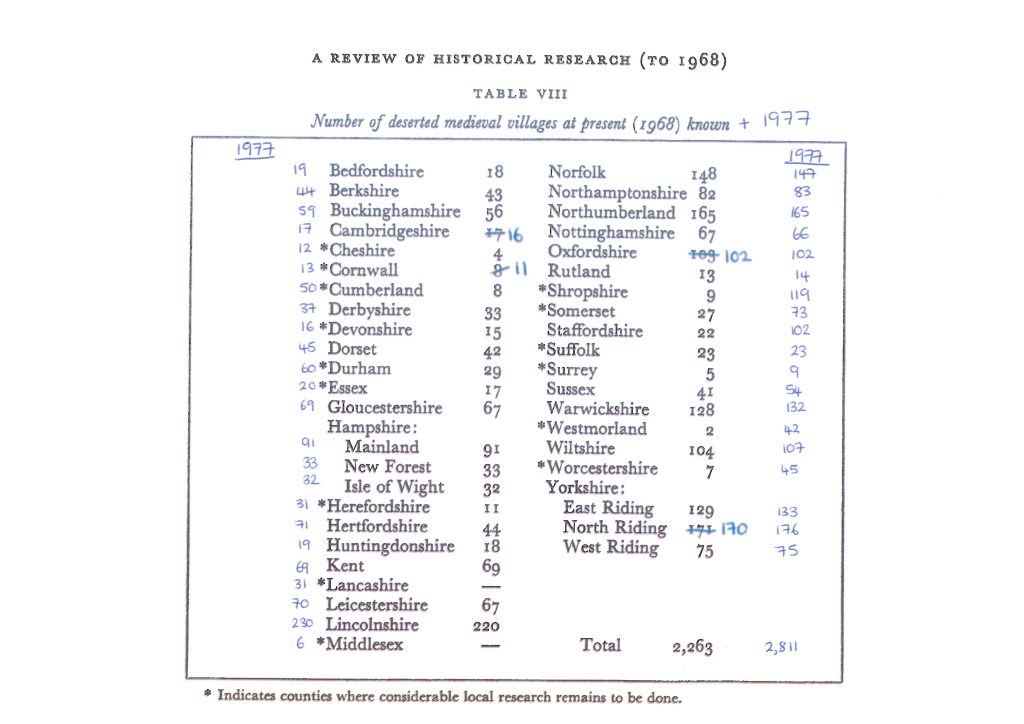
A total of 2,263 deserted medieval villages were recorded in 1968 and the table above shows the breakdown per county. There were some errors in the totals for each county but these evened each other out and the total remained 2,263. In 1977 a new distribution map of villages was published, and the total had grown to 2,811. Currently the Village Explorer shows the location of 2,222 sites. These are 2,146 of sites from the 1968 (the other 117 have no known location so cannot be plotted on the map), plus 76 new sites added for Berkshire. For information about each county, a list of sites, and links to further information about the sites that cannot be located, please click on the counties below.
The list of counties is taken from the official pre-1974 boundary data, and for some of the counties does break them down into smaller units than listed in the table above.
